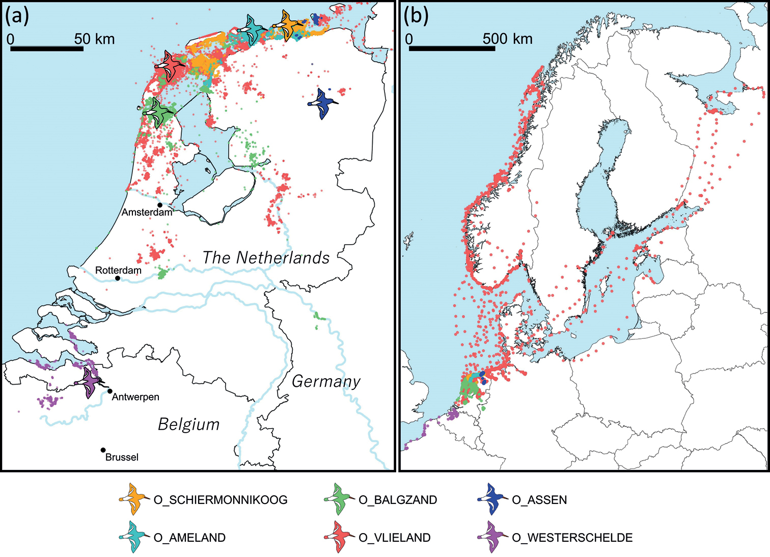
Maps of GPS positions collected from the six different datasets a map of the Netherlands and bordering areas of Belgium and Germany showing locations of study sites (indicated by bird symbols) and GPS locations b map of northwest Europe showing the full extent of the GPS locations. Maps show GPS locations with hourly intervals; higher frequencies in between GPS locations are omitted in this visualisation.


  Part of: van der Kolk H-J, Desmet P, Oosterbeek K, Allen AM, Baptist MJ, Bom RA, Davidson SC, de Jong J, de Kroon H, Dijkstra B, Dillerop R, Dokter AM, Frauendorf M, Milotić T, Rakhimberdiev E, Shamoun-Baranes J, Spanoghe G, van de Pol M, Van Ryckegem G, Vanoverbeke J, Jongejans E, Ens BJ (2022) GPS tracking data of Eurasian oystercatchers (Haematopus ostralegus) from the Netherlands and Belgium. ZooKeys 1123: 31-45. https://doi.org/10.3897/zookeys.1123.90623