|
||
|
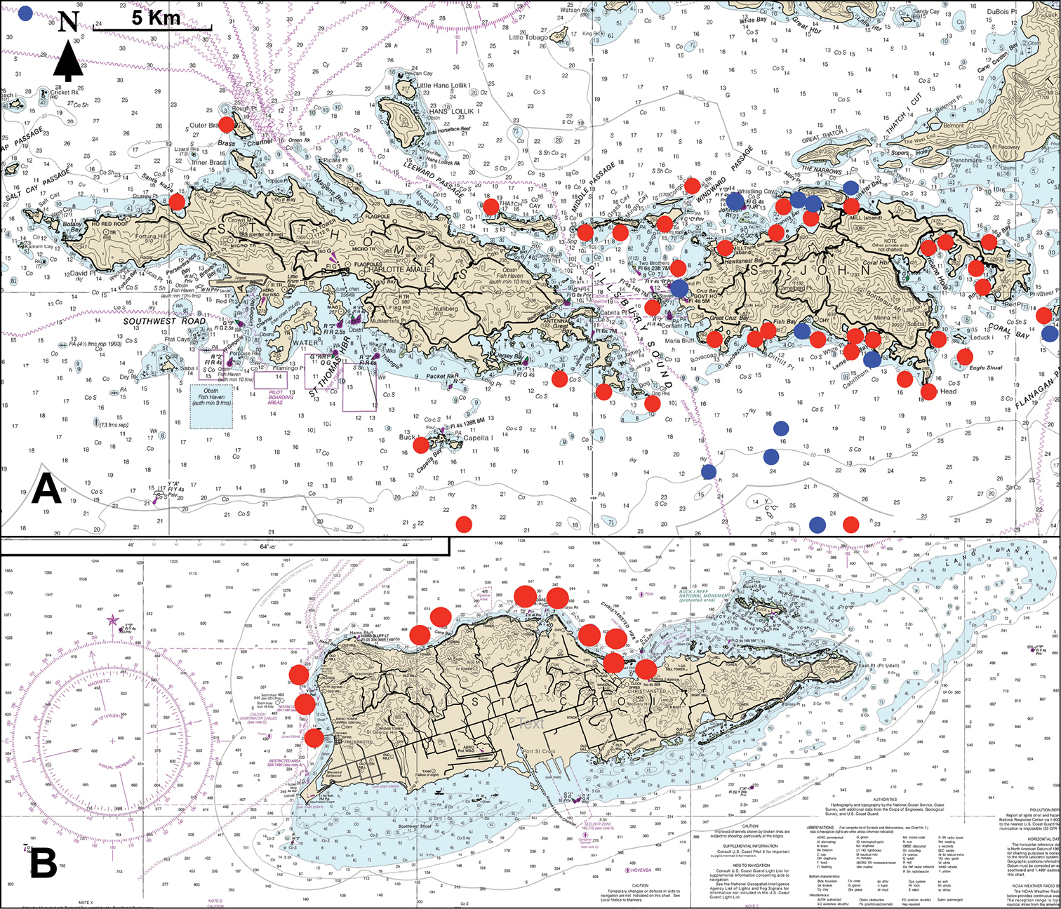
A dive sites generating fish-occurrence data at St. John and St. Thomas islands. Dive sites of CJE and AME are indicated by red symbols, and of other sources of voucher photographs by blue symbols. Note that some close-proximity sites are indicated by a single symbol. Symbols at the northern and southern edges of Fig. 1A are representative only, as their latitudes are outside the area of the map B dive sites of CJE and AME generating data at St. Croix. See Suppl. material 3: File S2A, B and Suppl. material 4: File S3 for further information. Base map in both cases: NOAA Chart 25641. |