|
||
|
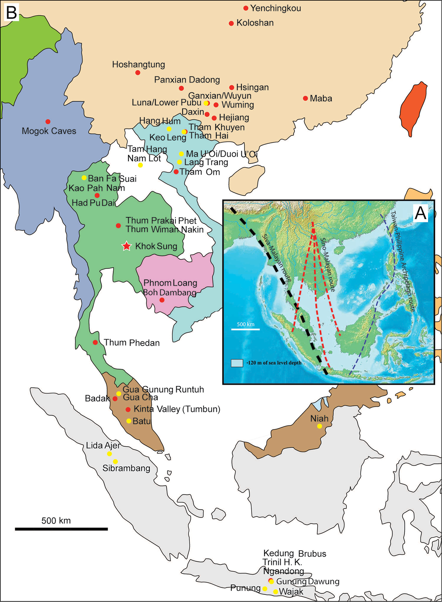
Map of Southeast Asia showing A the Sundaland boundaries and the migration route hypothesis: Siva-Malayan route (black), Sino-Malayan route (red), and Taiwan-Philippine Archipelago route (blue) and B the location of the Khok Sung sand pit (star) and other Middle (red circle) and Late (yellow circle) Pleistocene sites. The Sunda shelf boundaries at the sea level about 120 m lower than the present day are compiled from Voris (2000). Some Middle Pleistocene sites in South China and central Eastern China are shown in the map. Only Gua Cha (Peninsular Malaysia) is Holocene in age (Groves 1985, Bulbeck 2003). |