|
||
|
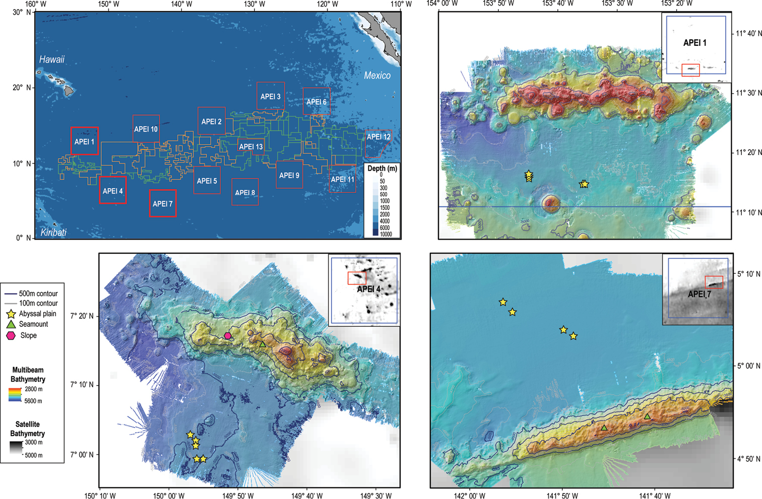
Map of the Clarion-Clipperton Zone (top left) indicating the nine Areas of Particular Environmental Interest (APEIs) in red, exploration areas in green, and reserved areas in orange. Shapefiles were sourced from https://www.naturalearthdata.com/downloads/10m-physical-vectors/10m-bathymetry/, and https://www.isa.org.jm/minerals/maps. Detailed maps of the study areas: APEIs 1 (top right), 4 (bottom left), and 7 (bottom right) show bathymetry from satellite values for the entire APEI, and multibeam values obtained during the DeepCCZ expedition. Sites, and specific geoform, where megafauna samples were collected are indicated as yellow stars in abyssal plains, green triangles in seamounts, and pink hexagons in seamount slopes. |