|
||
|
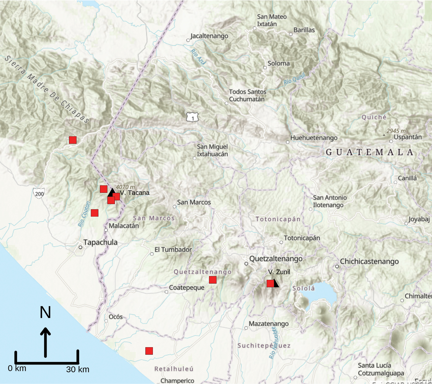
Map of the southern border regions of Guatemala and Chiapas, Mexico. Black triangles represent Volcán Tacaná and Volcán Zunil. Red squares represent museum specimens examined in this study. Note that some squares represent more than a single specimen. The record on the coastal plain of Quetzaltenango, Guatemala, is UMMZ 102472 which bears the locality Granja Lorena; we suspect that this is generalized locality information and the toad likely was collected to the north at higher elevation. |