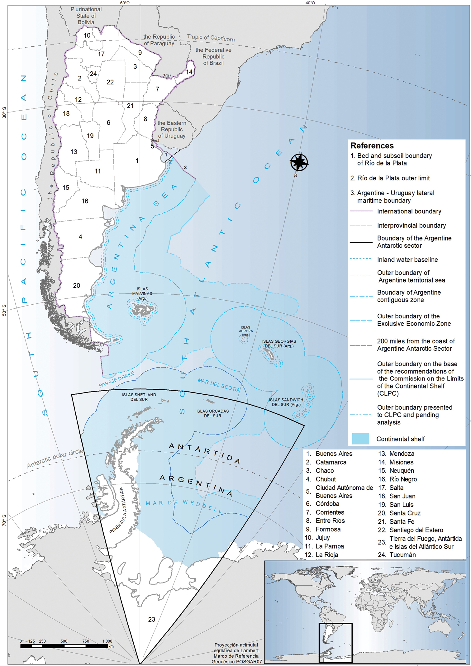
Political map of Argentina. International and national boundaries, including terrestrial and maritime, are indicated. Each of the 23 provinces and the autonomous city of Buenos Aires are depicted. Source of spatial information: National Geographic Institute (IGN 2021).


  Part of: Bauni V, Bertonatti C, Giacchino A, Schivo F, Mabragaña E, Roesler I, Rosso JJ, Teta P, Williams JD, Abba AM, Cassini GH, Cousseau MB, Flores DA, Fortunato DM, Giusti ME, Jayat JP, Liotta J, Lucero S, Aguirre TM, Pereira JA, Crisci J (2022) Biodiversity of vertebrates in Argentina: patterns of richness, endemism and conservation status. ZooKeys 1085: 101-127. https://doi.org/10.3897/zookeys.1085.76033