|
||
|
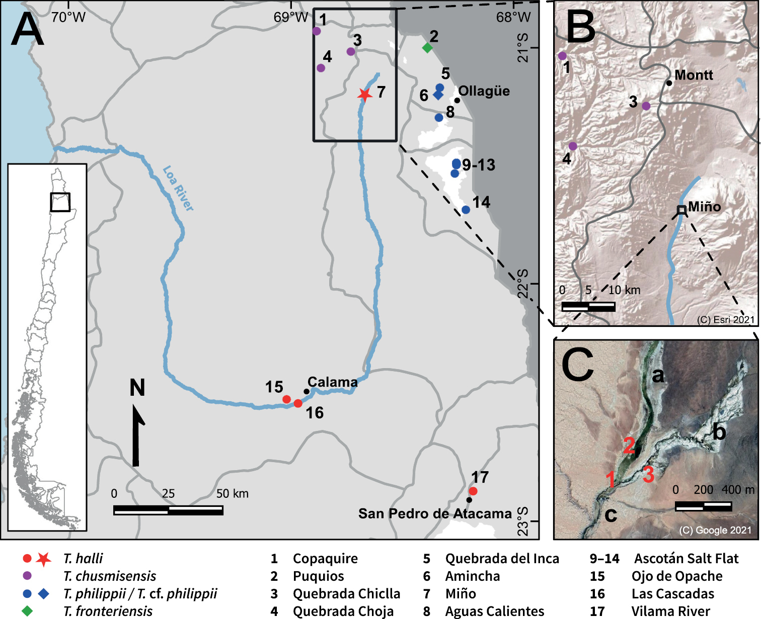
Geographic context of this study A distribution of all Telmatobius populations known from the southern range of the genus in Chile (20°55'–22°55'S). Light grey area = Chilean territory, dark grey area = Bolivian territory, grey lines = limits of the sub-basins, star = study site, diamonds = type localities B topographic relief of the surroundings of Miño. Grey lines = limits of the sub-basins. Montt is the name provided by the IHAEC for the Collahuasi Copper Mine C satellite image of Miño. 1) Concrete pool, 2) ruins of mining settlement, 3) sampling point, a) Miño River, b) Nacimiento Creek, c) Loa River. |