|
||
|
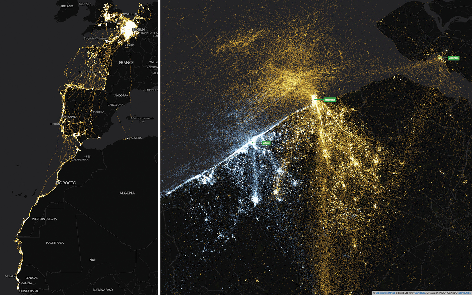
Left: map of western Europe and northwest Africa, showing the full extent of the gull tracking data, including two migration/wintering seasons. Right: map of the southern North Sea coast, showing mainly breeding season data. Each point represents a recorded occurrence, LBBG are indicated in orange, HG in blue. Overlapping points are brighter in colour. Maps created with CartoDB, basemap based on OpenStreetMap data. https://inbo.cartodb.com/u/lifewatch/viz/da04f120-ea70-11e4-a3f2-0e853d047bba/public_map |