|
||
|
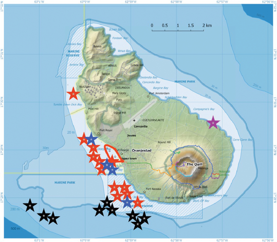
Study sites at Sint Eustatius Island. Location of dive sites during 2017 and 2020: Black stars indicate submersible dives, blue stars 2017 SCUBA dives, red stars 2020 SCUBA dives (some individual stars indicate multiple dives in very close proximity), purple star an intertidal snorkeling site, and the red outline shows limits of the shore-diving area in 2020. See Suppl. material 2: Table S1 for georeferenced date on dive sites. Generalized 20 m, 30 m, 200 m and 500 m isobaths in blue; other lines indicate marine and terrestrial reserve areas. (Base map from Statiaparks, openstreemap.org, CC-BY-SA 2.0 with bathymetry data corrected from CARMABI/WWF/E.Imms (https://www.dcbd.nl/document/bathymetry-map-seas-surrounding-st-eustatius-saba-and-st-maarten, accessed 10 July 2020) |