|
||
|
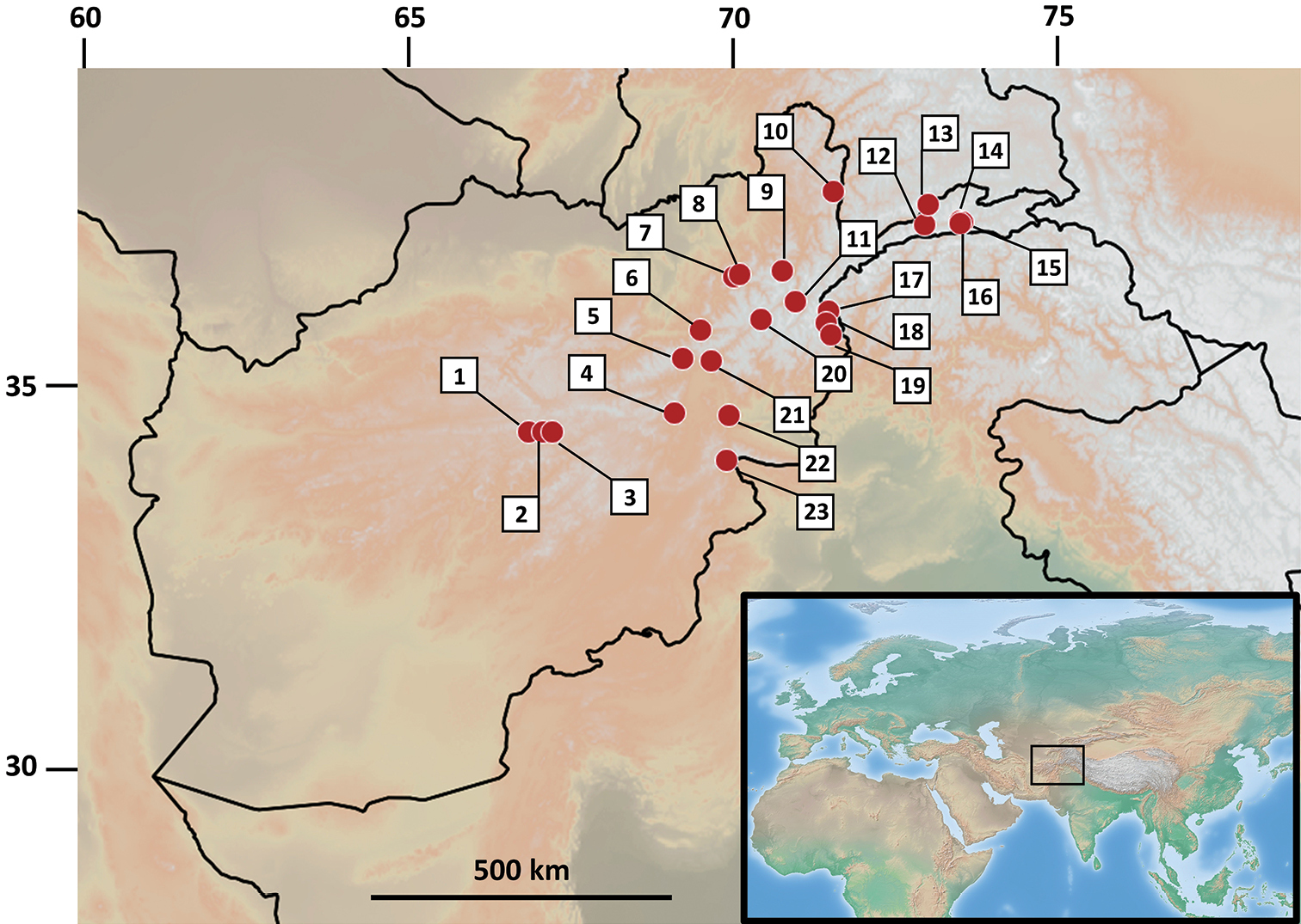
Map of Afghanistan and neighboring regions depicting the sampling examined as part of this study. Numbers correspond to the following locations: 1) Kotal-e-Asgharat; 2) Kotal-e-Narges, D-e-Godar; 3) Ghorghori-e-Panjao, Gaukhana; 4) Pagmangebirge; 5) Salang-Nord, vic. Khindjan / Salang-Paß; 6) Andarab; 7) upper Lezdi valley; 8) Lezdi; 9) Chodja-Mahomed [Kwaja Muhammed]; 10) Shiva-See; 11) Bala Kuran; 12) Kotal-e-Wazir; 13) Darrah-e-Istmotsh 14) Issiktal [Quellflur in Artemisia-Chenopodiensteppe]; 15) Ptukh; 16) Issik; 17) Ahmad Diwana (Baba); 18) Bashgal river; 19) Kamdesh, near Suingal/Shkurigal confluence; 20) Badakshan, Anjuman Pass; 21) Dar.-e-Pandjshir, Kotal-e-Tal; 22) Sarobi; 23) Safed Koh, Kotkai. GPS coordinates and altitude of these sites are given in Table 1 and in the associated database (Suppl. material 1). |