|
||
|
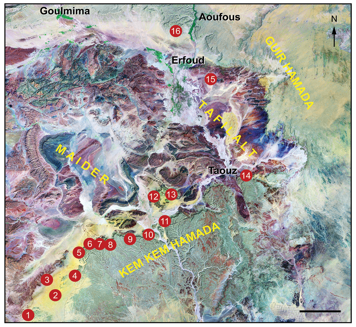
Landsat image of southeastern Morocco showing key localities, villages and cities, modified from Ibrahim et al. 2010. Scale bar equals 25 km. Abbreviations: 1 Tiknioune Bou Tazoult (just east of Zguilma), 2 Talidat, 3 Jbel Sdila, 4 Iferda Timenkhirt, 5 Gara Sbaa, 6 Oum Tkout, 7 Boumerade, 8 Moher, 9 locality just south of Zireg, 10 Daoura, 11 locality of the neotype of Carcharodontosaurus saharicus (Sereno et al. 1996), 12 Iferda N’Ahouar west, 13 Iferda N’Ahouar east, 14 Aferdou N’Chaft, 15 Hmar Lakhdad, 16 Douira Tagemout. |