|
||
|
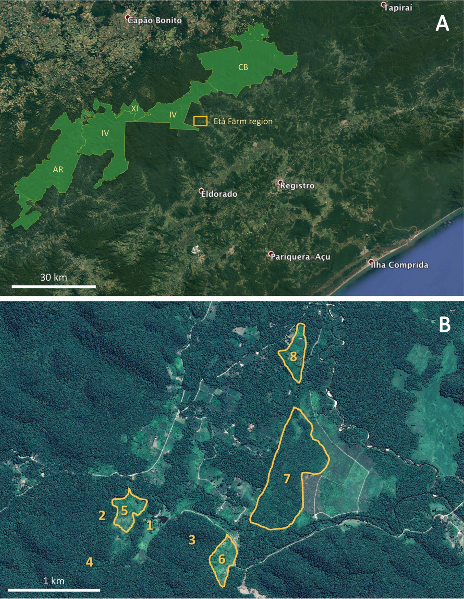
Satellite images (source: Google Earth) A the region where the study area (light orange rectangle) is located in the southern São Paulo State and the group of continuous protected areas (in light green) that encompasses most of the primary forests of this region (AR = Parque Estadual Turístico do Alto Ribeira; CB = Parque Estadual Carlos Botelho; IV = Parque Estadual Intervales; XI = Estação Ecológica de Xituê) as well as the location of the Etá Farm region (rectangle) B the region of the Etá Farm, Sete Barras Municipality where 1 indicates the Etá Farm administrative buildings, 2–4 indicate areas of forest, 5 and 6 indicate peach palm plantations; 7 indicates abandoned banana plantation, and 8 indicates an agricultural settlement. |