|
||
|
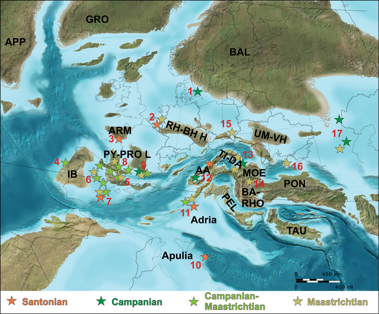
Paleogeographic distribution of the late Late Cretaceous (Santonian–Maastrichtian) European continental vertebrate assemblages (base map for late Campanian, ~ 75 Mya, courtesy of R. Blakey). Abbreviations: 1 Scania (southern Sweden) 2 Belgium-The Netherlands 3 western France 4 western Iberia (Portugal) 5 Cantabrian-southern Pyrenean region (northern Spain) 6 central Iberian region (central Spain) 7 eastern Iberian region (eastern Spain) 8 Languedoc (western southern France) 9 Provence (eastern southern France) 10 Apulia (southern Italy) 11 Adriatic-Dinaric Carbonate Platform (eastern Italy, Slovenia) 12 Austroalpine region (eastern Austria, western Hungary) 13 Transylvania (northwestern Romania) 14 northern Bulgaria 15 southeastern Poland 16 Crimea 17 southern Russia (for details, see also Figs 1, 4 and text); AA Austroalpine Domain; APP Appalachia; ARM Armorican Massif; BA-RHO Balkans-Rhodope Orogen; BAL Baltic Landmass; GRO Greenland; IB Iberian Landmass; MOE Moesian Platform; PEL Pelagonian Domain; PON Pontides Orogen; PY-PRO L Pyrenean-Provencal Landmass; RH-BH H Rhenish-Bohemian High; TAU Taurus Block; TI-DA Tisia-Dacia Block; UM-VH Ukrainian Massif-Voronezh High. Note that emergent land was more extensive during Maastrichtian times than represented in the map, with most Spanish-French localities situated in purely continental setting (compare with Fig. 11). |