|
||
|
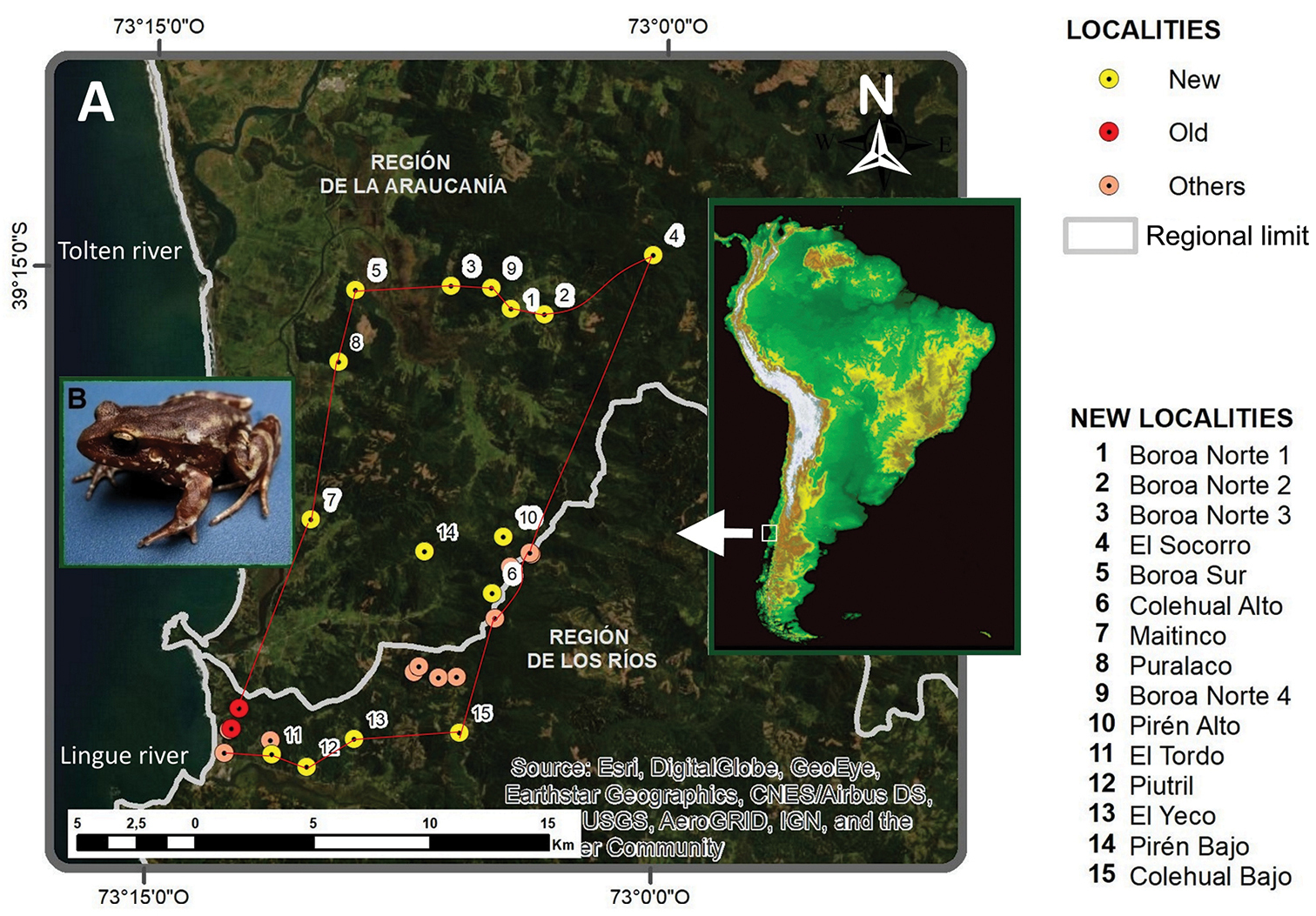
A Distribution map of Eupsophus migueli. The red polygon corresponds to an updated distribution area of E. migueli, and it is formed by georeferenced landmarks including new records (this paper), old records (including the type locality, Mehuín, and nearby localities Queule and Pichicuyín) and other documented points (Méndez et al. 2005, Contreras 2014, Miranda 2015) B specimen of E. migueli from Colehual Alto. |