|
||
|
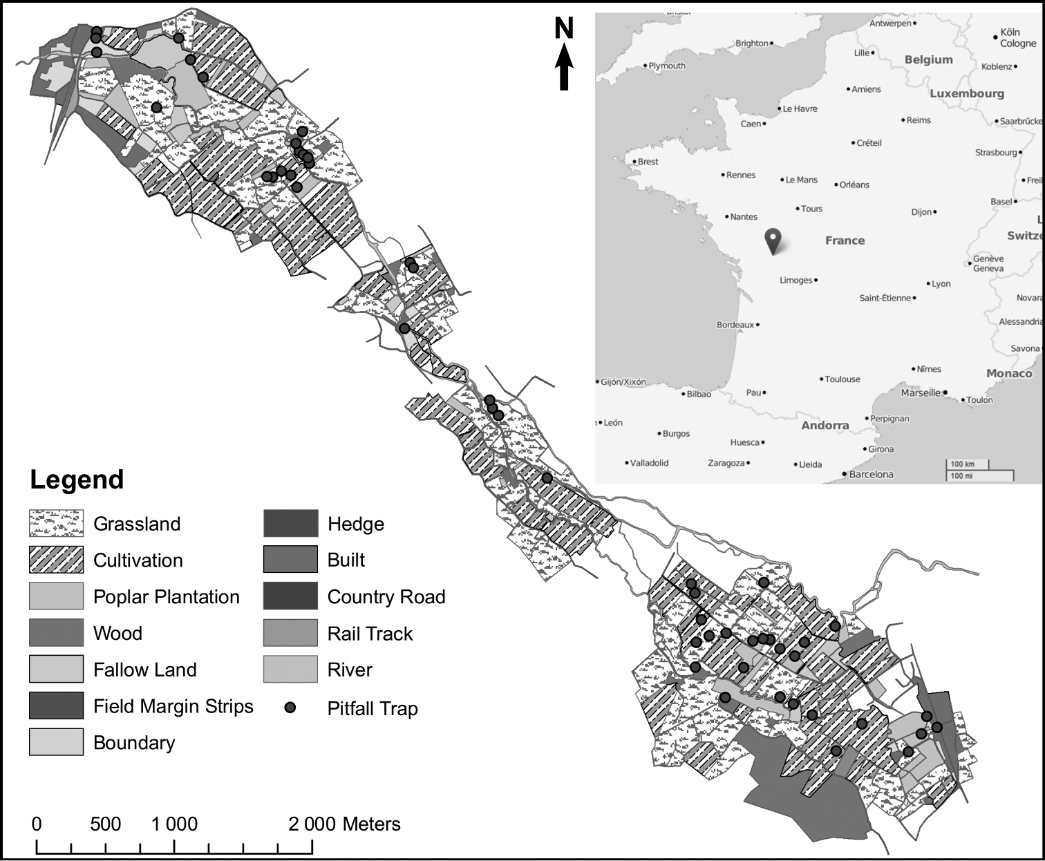
Land cover map with sampling sites in Plaine Mothaise, central-western France. Land cover features of the study site were determined using aerial photographs (Google Earth) and field inspections. Linear characteristics from the landscape were distinguished such as riparian, hedge, continuous and intermittent vegetation. The final categories obtained are Cultivation (crops), Grassland, Poplars, Types of connection, roads and urban. Landscapes were mapped using Arcmap 9.3 (ESRI, 2004) as a main geographical information system. Black dots indicate sites of pitfall trap sampling. |