|
||
|
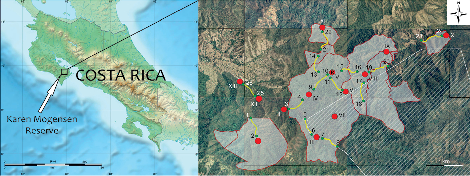
Map of Costa Rica and the Karen Mogensen Reserve. The areas in white, bordered by red lines, are parts of the Karen Mogensen Reserve added to the original nucleus over years. The area filled by a striped pattern represents the biological corridor of the Nicoya Peninsula and the additional protected forested land adjacent to the Karen Mogensen Reserve. “R” shows the position of the Research Station. Red dots are the fixed points, yellow lines are the transects used for the data collection during the surveys; green dots represent the transects endpoints. Numbers and Roman numerals refer to Table 1. |