|
||
|
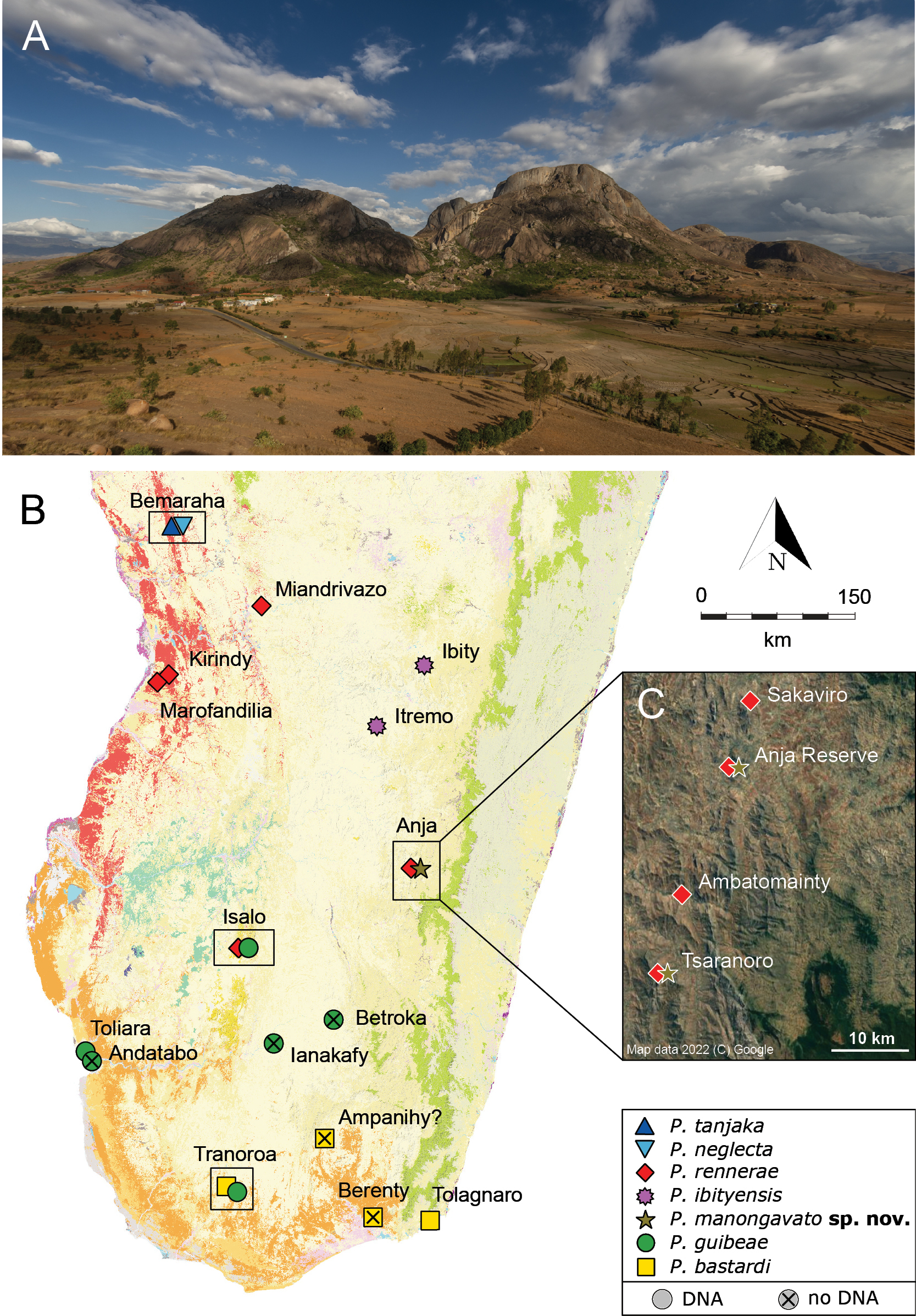
A Panoramic view of Anja Reserve, south of the city of Ambalavao (Fianarantsoa Province) B distribution of the different species within the P. bastardi clade, updated from Miralles et al. (2021) by adding Itremo for P. ibityensis (FGMV 2001-D37) and Ianakafy for P. guibeae (FMNH 73059). The exact geographic position of Ampanihy remains uncertain. Species symbol colours match the colours of the phylogenetic trees and haplotype networks. Black rectangles highlight localities with sympatric lineages. The map shows the remaining primary vegetation of Madagascar (https://kew.iro.bl.uk/): evergreen humid forest (green), deciduous dry forest (red), spiny arid forest (orange), tapia forest (yellow), western sub-humid forest (blue), mangroves (purple), cultivation (pink) and south western coastal bushland (grey) C satellite image with new records of P. rennerae and P. manongavato sp. nov. in the area south of Ambalavao. Map data 2022 (C) Google. Photographs by JLR. |