|
||
|
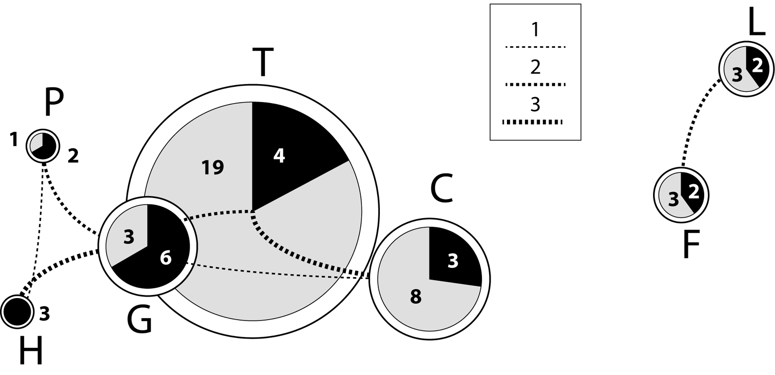
Graphical representation of the island endemisms and the species shared between islands. Pie sizes are proportional to the number of species on each island. Black sectors: number of species shared with other islands; grey sectors: proportion of local endemisms. Lines connecting pies: number of shared species between the corresponding islands, the width of the lines being proportional to the number of shared species. The disposition of pies reflects the geographical arrangement of the islands: P: La Palma, H: El Hierro, G: La Gomera, T: Tenerife, C: Gran Canaria, F: Fuerteventura, L: Lanzarote. |