|
||
|
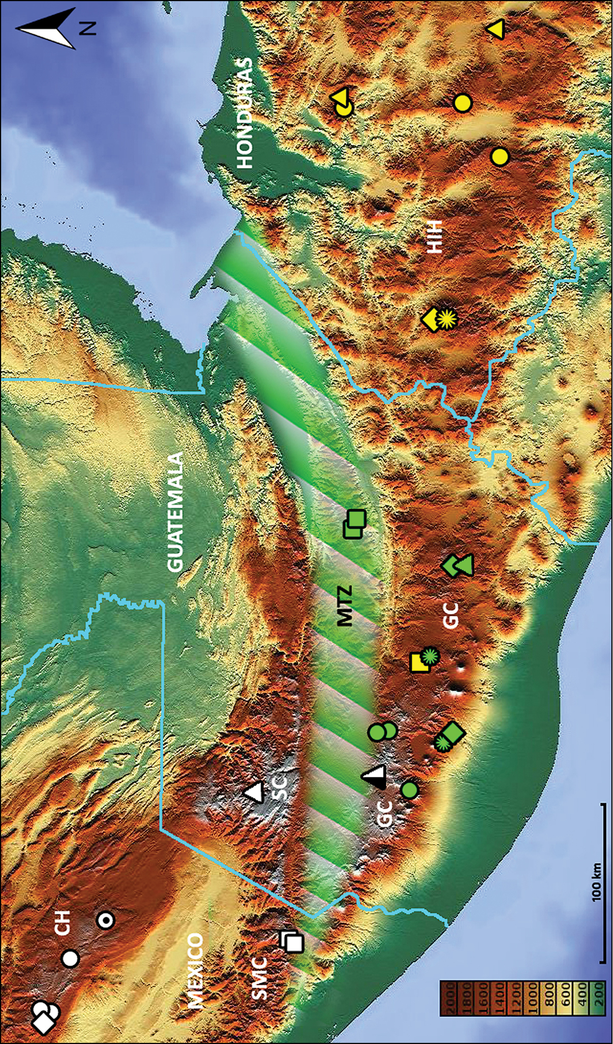
Map of southern Mexico, Guatemala and adjacent part of Honduras, showing positions of locality records for the species of Geocharidius: white diamond, G. andersoni; white circles (black point in a circle shows “terra typica” for the species), G. zullinii; white squares, G. vignatagliantii; white triangle, G. gimlii; black and white triangle, G. integripennis; green squares, G. longinoi; green circles, G. erwini; green flowers, G. minimus; green diamonds, G. balini; green triangle, G. jalapensis; yellow quadrangle, G. antigua; yellow diamond, G. lencanus; yellow flower, G. celaquensis; yellow triangles, G. disjunctus; yellow circles, G. comayaguanus. Physiographic features: CH, Chiapas Highlands; GC, Guatemalan Cordillera; HIH, Honduran Interior Highlands; MTZ, Motagua Fault Zone; SC, Sierra de los Cuchumatanes; SMC, Sierra Madre de Chiapas. Elevation scale bar is given in meters. |