|
||
|
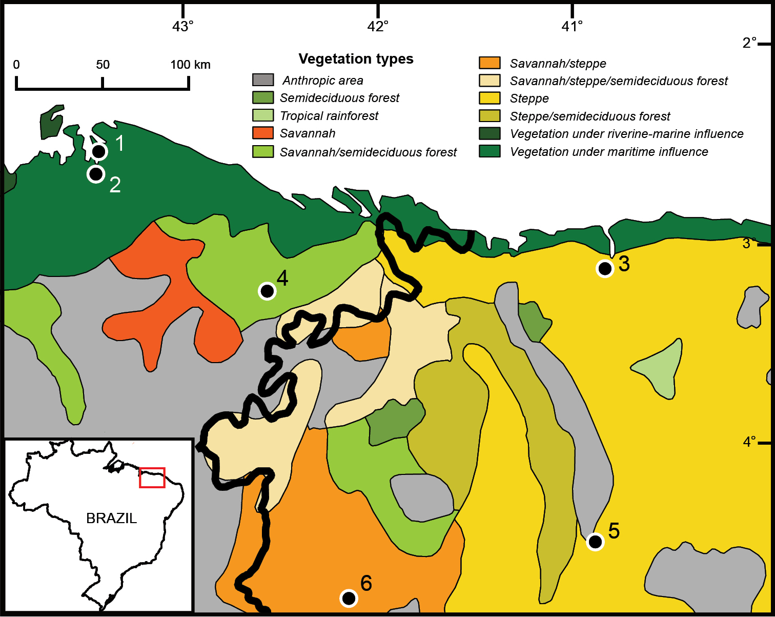
Localities of Alouatta belzebul ululata reported in the literature (Viana et al. 2015). Borders of biomes and habitat types as regarded by the Instituto Brasileiro de Geografia e Estatística (IBGE 2004a, b). Thick line represents the borders of the Cerrado (left) and the Caatinga (right) according to the IBGE (2004a). Localities: 1 Maranhão, Primeira Cruz (Igarapé das Palmeiras) (2.50°S, 43.33°W; Gregorin 2006) 2 Maranhão, Humberto de Campos (antiga Miritiba) (2.62°S, 43.45°W; Gregorin 2006) 3 Ceará, Granjá (Goiabeira) (3.10°S, 40.83°W; Gregorin 2006) 4 Maranhão, Boa Vista (3.22°S, 42.57°W; Gregorin 2006) 5 Ceará, São Benedito (Bom Jardim) (4.50°S, 40.88°W; Gregorin 2006); Piauí, Campo Maior [4.50°S, 40.88°W; description of locality from Viana et al. (2015); coordinates assigned by us and assessed via Google Earth version 7.1.7.2602]. Geographic coordinates in decimal degrees rounded to the nearest tenth. The original names in Portuguese for the vegetation types as reported by the IBGE (2004b) and their corresponding translation into English are as follows: área antropizada (anthropic area); floresta estacional semidecidual (semideciduous forest or dry forest); floresta ombrófila aberta (tropical rainforest); savana (savannah); savana/floresta estacional (savannah/semideciduous forest); savana/savana estépica (savannah/steppe); savana/savana estépica/floresta estacional (savannah/steppe/semideciduous forest); savana estépica (steppe); savana estépica/floresta estacional (steppe/semideciduous forest); vegetação com influência fluviomarinha (vegetation under riverine-marine influence); vegetação com influência marinha (vegetation under maritime influence). |